

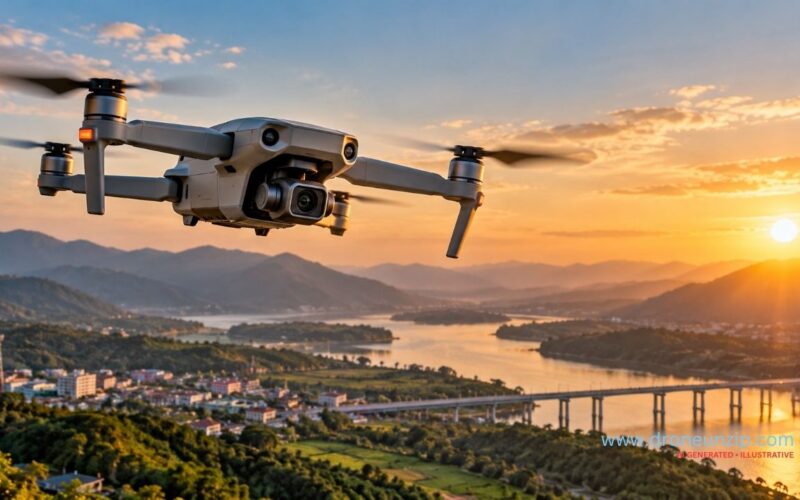
Two drones can both advertise 4K video and still produce very different results. One may be built to capture smooth travel footage, another to fly through tight FPV lines, and a third to detect heat or measure crop differences invisible to a normal camera. The useful question is not simply “How many megapixels?” It is “What does this camera let me see, measure or create, and what can it not tell me?”
Use the comparison below as a starting point. Then explore the real specifications from manufacturer documentation, the trade-offs behind the numbers, and the camera type that best fits your task in India. This is a technical buying guide, not a claim that one camera or brand is best for everyone.
What is a drone camera?
A drone camera is an imaging system carried by an unmanned aircraft. On consumer drones, the camera is usually integrated into the aircraft and mounted on a stabilising gimbal. On professional platforms, the camera may be a replaceable payload selected for a particular job, such as surveying, thermal inspection or crop analysis.
The complete imaging system includes more than the camera sensor. The lens determines the field of view; the gimbal or electronic stabilisation helps control movement; the aircraft affects vibration and flight stability; and the recording system determines available resolutions, frame rates, formats and data rates.
Main types of drone cameras
1. Standard RGB cameras
RGB cameras capture visible-light photographs and video in colour. They are common on consumer camera drones and are used for travel footage, real-estate visuals, event filming, filmmaking and general documentation. Their capabilities range from basic fixed cameras to larger-sensor systems with manual exposure controls and advanced video profiles.
2. FPV cameras
First-person-view (FPV) drones carry a camera that sends a live view to goggles or a screen so the pilot can navigate from the aircraft’s perspective. The onboard recording camera may be the same unit or a separate action camera. FPV systems prioritise a responsive live feed and low latency, while cinematic FPV setups also need to manage image quality, vibration and stabilisation.
3. Thermal cameras
Thermal cameras detect infrared energy and represent temperature differences as an image. They can support electrical inspections, building-envelope checks, search-and-rescue work and some industrial monitoring tasks. A thermal image is not automatically a precise temperature measurement: results depend on sensor capability, calibration, emissivity settings, distance and environmental conditions.
4. Multispectral and mapping cameras
Multispectral systems record selected wavelength bands that are not captured in a normal RGB photograph. They can be used in agricultural monitoring and environmental analysis when the imagery is collected and interpreted correctly. Mapping cameras, meanwhile, are selected for consistent image capture, suitable overlap and geospatial workflows. Some surveying systems combine a visible-light camera with RTK or PPK positioning; the camera alone does not guarantee survey-grade accuracy.
Drone camera specifications that actually matter
Sensor size and image quality
Sensor size is one of the most useful specifications to compare. In general, a larger sensor can gather more light and may deliver cleaner low-light footage and greater flexibility in bright-to-dark scenes, although lens design, processing and the specific sensor also matter. Megapixels describe image dimensions, not the whole quality of the image. A high megapixel figure cannot by itself guarantee better detail, colour or night performance.
Resolution and frame rate
Resolution describes the number of pixels in a recorded image. 4K offers more pixels than Full HD, but the result also depends on sensor quality, lens sharpness, compression and how the footage will be viewed or edited. Frame rate is a separate choice: higher frame rates can help create slow motion, but they may involve trade-offs in resolution, light sensitivity or recording settings. Check the exact modes available, not just the largest number printed on the box.
Lens, field of view and aperture
A wide field of view captures more of the scene, which is useful for landscapes and immersive FPV footage, but it can make nearby objects look stretched. A narrower view can help frame distant subjects. Aperture affects how much light reaches the sensor, while lens quality influences sharpness and distortion. If the drone will be used for repeatable inspection or mapping, lens consistency and image geometry may matter more than dramatic wide-angle footage.
Mechanical gimbal versus electronic stabilisation
A mechanical gimbal physically moves the camera to counter aircraft motion. Many camera drones use a multi-axis gimbal to keep footage level while the aircraft pitches and rolls. Electronic image stabilisation (EIS) corrects motion through software and may crop or reframe the image. Some FPV drones combine a limited mechanical gimbal with electronic stabilisation. Neither label alone tells the whole story, so look for sample footage and check whether stabilisation works in the recording modes you intend to use.
Bitrate, colour profiles and file formats
Bitrate affects how much data is used to represent each second of video. Higher bitrate can preserve more detail in complex scenes, but it also creates larger files and does not compensate for a poor sensor or lens. Flat or log-style colour profiles can offer more flexibility during colour grading, but they require an appropriate editing workflow. Check supported codecs, memory-card requirements, audio options where relevant, and whether your computer can handle the footage.
Live transmission and recording are different
The live view sent to a controller or FPV goggles is not necessarily recorded at the same quality as the onboard footage. Transmission range claims also do not mean that a pilot should fly that far. Real-world signal quality depends on interference, obstacles, antenna placement and local conditions, and flights must remain within applicable legal and safety limits.
Real-world examples: how camera specifications change by job
Manufacturer specifications make the differences concrete. These examples are not a ranking: each system is designed around a different imaging task. Figures below are taken from the linked manufacturer documentation and may vary by configuration or firmware.
| Example system | Documented camera capability | What it is designed to do | What the specification tells a buyer |
|---|---|---|---|
| DJI Mavic 4 Pro | Three-camera system; main 4/3 CMOS camera, 100 MP stills and up to 6K/60fps HDR video, plus medium- and telephoto cameras | High-end aerial photography and video with multiple focal lengths | Multiple lenses can change framing without relying entirely on digital crop. High resolution is useful, but it does not replace good exposure, composition or stabilisation. |
| DJI P4 Multispectral | Six-camera system; five multispectral bands include blue, green, red, red edge and near-infrared, plus an RGB camera | Vegetation mapping and agricultural analysis | The value lies in calibrated spectral data and repeatable mapping workflow, not in a headline megapixel count. The resulting index needs appropriate capture and interpretation. |
| DJI Zenmuse H30T payload | Visible-light wide and zoom cameras alongside a thermal imager; thermal video up to 1280 × 1024 at 30 fps | Industrial inspection, firefighting support, search and rescue and infrastructure checks | Thermal resolution and temperature-measurement modes matter for inspection. The H30T is a specialist payload for compatible enterprise aircraft, not a consumer camera-drone accessory. |
Important distinction: the Mavic example records visible-light imagery, the P4 Multispectral samples selected wavelength bands, and the H30T detects infrared radiation. These outputs answer different questions. A normal RGB image cannot substitute for a calibrated thermal reading or multispectral analysis.
Where drone cameras are used
- Photography and filmmaking: landscapes, travel, real estate, events and cinematic establishing shots.
- Construction and infrastructure: visual progress records, roof checks and inspection of difficult-to-reach structures.
- Agriculture: crop scouting and multispectral analysis when suitable sensors and validated workflows are used.
- Surveying and mapping: image capture for photogrammetry, orthomosaics and 3D models, with accuracy depending on the full survey method.
- Public safety and search: situational awareness and, where suitable, thermal imaging to help locate people or identify heat patterns.
- FPV content: immersive action footage and fast-moving shots where low-latency piloting is important.
How to choose a drone camera for your needs
Start with the work you need the drone to perform, then compare the features that affect that work. A creator making travel videos may prioritise a stabilised camera, portability, dependable tracking and manageable file sizes. A survey team may need a consistent lens, reliable geotagging and a workflow compatible with its mapping software. An inspection team may need optical zoom or a thermal payload rather than the highest consumer-video resolution.
- For beginners: prioritise stable flight, straightforward controls, safety features, accessible spare parts and a camera that produces consistent results.
- For social media and travel: check stabilisation, vertical-video options, weight, quick setup and how easily footage transfers to your phone.
- For professional video: compare sensor performance, frame rates, colour profiles, bitrate, lens options and the cost of batteries and storage.
- For surveying: confirm camera calibration, shutter type, positioning support, mapping-software compatibility and the accuracy requirements of the project.
- For agriculture or inspection: choose the sensor for the measurement or inspection task, and check that the data can be interpreted with a suitable workflow.
What to check before buying in India
Before paying, verify the exact model and configuration, warranty terms, repair support, availability of batteries and propellers, controller compatibility, memory-card requirements and the total kit contents. Be cautious with vague claims such as “4K camera” or “professional quality” unless the seller provides the actual sensor, recording modes and stabilisation details.
Also check the current Indian requirements for the specific drone and intended operation. The applicable rules can depend on the aircraft category, operation and any relevant exemptions or permissions. Consult the official DGCA website and Digital Sky resources before flying, and check the airspace and permissions relevant to your planned location. Do not rely on a retailer’s product description as legal advice.
If price is your main question, see our separate guide to drone prices in India by type and use. For a model-focused comparison, our existing guide to drones for professional photography in India serves a different purpose from this technical explainer.
Common drone camera buying mistakes
- Choosing by megapixels alone and ignoring sensor size, lens quality and stabilisation.
- Assuming “4K” means every available mode records at 4K or that all 4K footage looks equally good.
- Confusing the live video feed with the quality of the original onboard recording.
- Ignoring battery availability, repair support, storage needs and the full cost of operating the drone.
- Buying a specialised thermal or multispectral camera without confirming the analysis software and workflow needed to use its data.
- Assuming a drone can be flown anywhere because it is available for sale.
FAQs
Is a higher megapixel drone camera always better?
No. Megapixels indicate image dimensions, but sensor size, lens quality, processing, lighting and stabilisation also influence the final result.
Is 4K enough for professional drone video?
It can be enough for many professional projects, but the right choice depends on the delivery format, cropping needs, frame rate, bitrate, colour workflow and image quality. Resolution alone is not a guarantee of professional results.
What is the difference between a gimbal and EIS?
A gimbal mechanically moves the camera to counter motion. EIS uses software to reduce visible movement and may crop or reframe the image. Some drones use both systems.
Can a drone camera be used for land surveying?
Yes, suitable cameras can collect imagery for mapping and photogrammetry. The accuracy depends on factors including camera characteristics, image overlap, positioning, ground control, processing and survey practice. A camera-equipped drone does not automatically produce survey-grade results.
Do I need permission to fly a camera drone in India?
Requirements depend on the drone and the intended operation, and applicable exemptions may exist. Check current DGCA guidance and the official airspace resources before each flight rather than assuming that one rule applies to every drone.
Conclusion
The right drone camera is the one that produces the data or footage your job actually requires. Look beyond marketing labels: compare sensor and lens performance, stabilisation, recording modes, transmission, support and the complete operating workflow. Match those choices to your intended use, then verify the applicable Indian rules before flying.
