

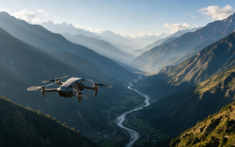
India offers an extraordinary range of landscapes for drone photography, from Himalayan valleys and tea-covered hills to coastlines, salt deserts and river islands. For drone enthusiasts and travel creators, these places offer opportunities to capture perspectives that are difficult to achieve from the ground.
However, finding the best places to fly drones involves more than choosing a beautiful view. Airspace restrictions, protected monuments, local site rules, weather, crowds and access permissions can all affect whether a flight is possible.
This guide explores scenic destinations worth considering for drone photography in India, explains what to check before flying and provides a practical checklist for planning a responsible flight. The locations listed are not blanket approvals to fly. Always verify the exact launch site and planned operation before take-off.
What Makes a Good Drone Photography Location?
A strong location combines visual interest with a realistic opportunity to operate safely and lawfully. Before selecting a destination, consider four factors:
- Visual variety: Mountains, coastlines, rivers, plantations and unusual terrain can create compelling aerial compositions.
- Space and surroundings: Open terrain may provide more room to operate than crowded streets or busy public attractions, but open space alone does not make a flight legal.
- Access and local restrictions: Landowners, monument authorities, forest officials, park managers and local administrations may impose conditions independent of the national airspace map.
- Weather and visibility: Wind, rain, mist, heat and changing light can affect image quality and flight safety.
A location that looks ideal in a travel video may not be suitable for your particular drone, flight plan or date.
Best Places to Fly Drones in India: Scenic Locations to Consider
The following destinations offer distinctive landscapes for aerial photography. Treat each as a starting point for research, then check the exact location, access conditions and current restrictions.
1. Ladakh: High-Altitude Mountain Landscapes
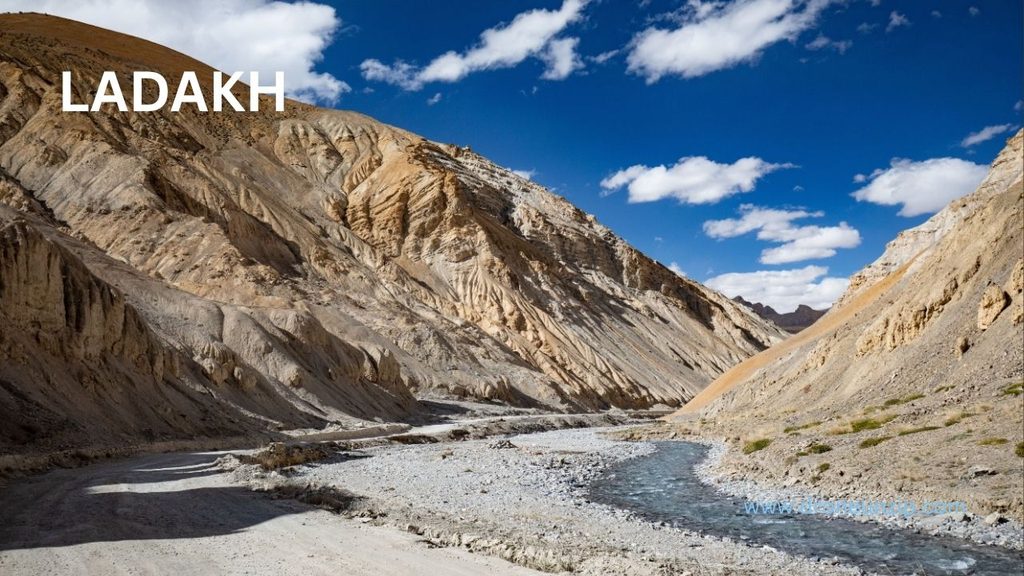
Ladakh is known for dramatic mountain terrain, broad valleys, stark rock formations and striking contrasts between barren hills and blue water. These features can create strong wide-angle compositions and sweeping landscape footage.
Photography opportunities: Mountain ridgelines, valley patterns, winding roads viewed from permitted locations and changes in colour across the terrain.
What to check before flying: Ladakh’s sensitive border geography and the presence of restricted or security-sensitive areas make location-specific checks especially important. Do not assume that a remote viewpoint or a scenic lakeside is open to drone operations.
Practical consideration: High altitude and wind can affect battery performance and flight handling. Check the drone manufacturer’s operating limits and current weather conditions before planning a flight.
2. Spiti Valley, Himachal Pradesh: Rugged Terrain and River Valleys
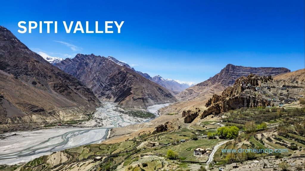
Spiti’s rugged mountains, dry slopes, river valleys and settlements create a very different visual character from greener Himalayan regions. The landscape can work particularly well for wide establishing shots and compositions that show the scale of the terrain.
Photography opportunities: Valley contours, river bends, mountain textures and roads framed by dramatic terrain, where flight is permitted.
What to check before flying: Verify the precise airspace classification, local access restrictions and any rules applicable to the intended site. Do not treat the remoteness of a location as evidence that drone operations are allowed.
Practical consideration: Mountain weather can change quickly. Strong gusts, cold conditions and limited emergency landing options deserve particular attention.
3. Munnar, Kerala: Tea Plantations and Rolling Hills
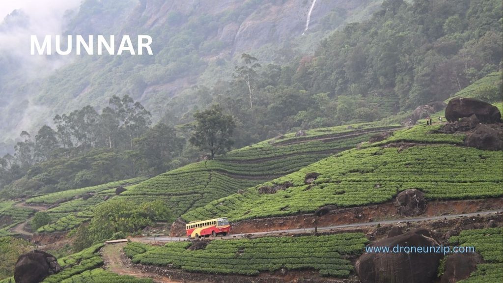
Munnar’s tea-covered hills provide layered green patterns, curving plantation roads and a textured landscape that can look especially effective in soft morning light.
Photography opportunities: Plantation patterns, contours across the hills and landscape compositions that combine cultivated slopes with distant ridgelines.
What to check before flying: Establish whether the proposed launch point is on private plantation land, within a managed tourist property or subject to other local restrictions. Obtain the relevant landowner or site permission where needed, and separately check airspace.
Practical consideration: Mist and rain may reduce visibility and make flying unsafe. Wait for suitable conditions rather than trying to capture a shot in deteriorating weather.
4. Kerala Backwaters: Waterways and Green Landscapes
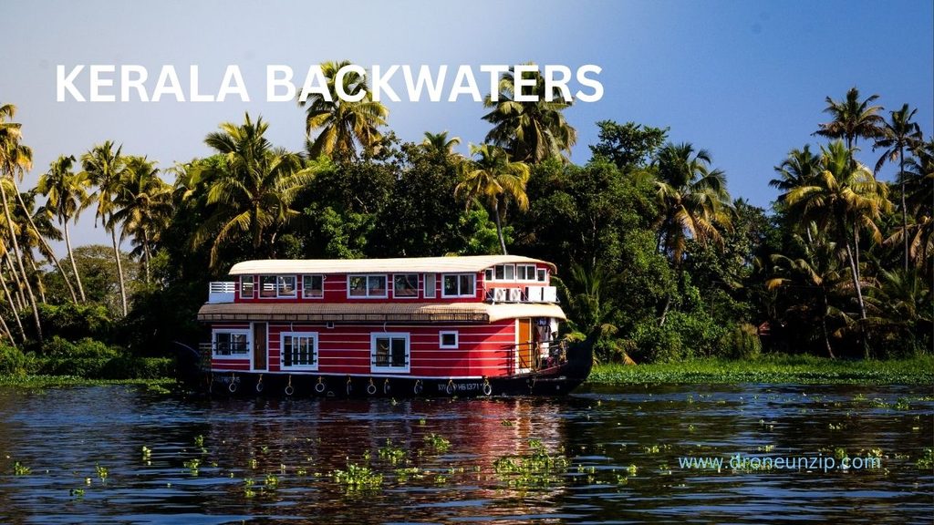
Kerala’s backwaters offer winding waterways, palm-lined banks, fields and settlements. Their patterns can create attractive overhead compositions, especially when water and vegetation form contrasting shapes.
Photography opportunities: Waterway patterns, landscape transitions and broad views from a permitted location that does not disturb residents or water traffic.
What to check before flying: Confirm access to the take-off point, the relevant airspace status and any local restrictions. Avoid assuming that a public-looking bank, canal or waterfront automatically permits drone operations.
Practical consideration: Wind over open water, reflections and changing light can affect a shot. Keep a conservative safety margin and avoid manoeuvres that risk losing the drone over water.
5. Goa: Coastal Landscapes and River Mouths
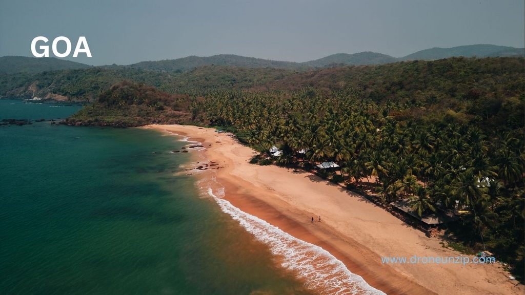
Goa’s coastline offers beaches, headlands, estuaries and vegetation-backed shores. The visual variety makes the region appealing to travel photographers, but popular tourist areas can also be crowded.
Photography opportunities: Coastal curves, waves meeting the shore, river mouths and broad landscape views from suitable, permitted sites.
What to check before flying: Check the current airspace map and the rules of the specific beach, property or managed site. Avoid flying over crowds, and do not assume that a quiet beach at sunrise is automatically unrestricted.
Practical consideration: Coastal winds can be stronger than expected. Check wind conditions and leave sufficient distance from people, buildings and obstacles.
6. The Rann of Kutch, Gujarat: Salt-Desert Textures
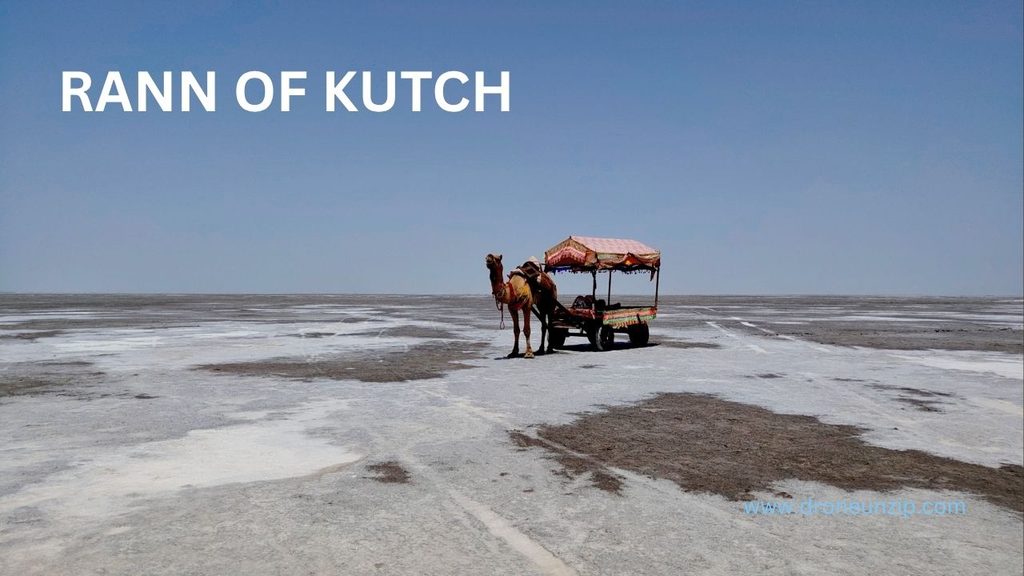
The Rann of Kutch is known for its expansive salt-flat landscape and distinctive seasonal appearance. Its wide horizons and subtle surface patterns can create minimalist aerial imagery.
Photography opportunities: Broad geometric compositions, salt-flat textures and horizon-led landscape shots, where authorised.
What to check before flying: Determine whether the planned site falls within a restricted or managed area, including any applicable conservation, event or local-administration restrictions. A large open landscape does not itself establish permission.
Practical consideration: Heat, glare and wind can complicate operations. Check conditions on the day and avoid launching if the environment exceeds your drone’s operating limits.
7. Meghalaya: Waterfalls, Forests and Green Valleys
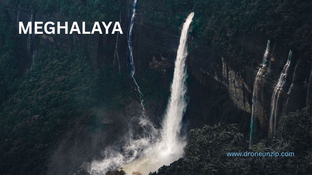
Meghalaya’s waterfalls, forested slopes and deep green valleys offer strong contrasts in texture and elevation. These landscapes can be visually striking, but some locations are difficult to access and environmentally sensitive.
Photography opportunities: Waterfall landscapes, forested ridges and broad valley views from authorised locations.
What to check before flying: Confirm whether the location is within a protected area or subject to forest-department, site-management or local permissions. Do not disturb wildlife or visitors, and do not fly merely because a location is accessible on foot.
Practical consideration: Rain, mist, moisture and variable visibility can make flying difficult. Protect equipment and avoid flights in conditions that compromise safe control.
8. Majuli, Assam: River-Island Landscapes
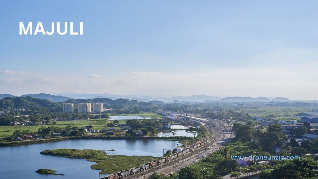
Majuli’s riverine setting, fields and settlements offer a different perspective on India’s landscapes. The visual interest comes from the relationship between land, water and human activity.
Photography opportunities: River channels, field patterns and broad landscape compositions from suitable permitted locations.
What to check before flying: Verify airspace, access rights and local restrictions. Keep a respectful distance from homes, community spaces, religious sites and people who have not consented to being filmed.
Practical consideration: Conditions near rivers can change, and open terrain can be exposed to wind. Plan a safe launch and recovery area before starting.
9. Orchha, Madhya Pradesh: Historic Architecture and River Scenery
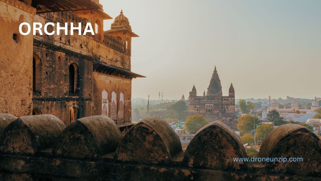
Orchha combines historic architecture with a river landscape, making it visually appealing to photographers interested in built heritage and natural surroundings.
Photography opportunities: River bends, broad views of the town and architectural context from locations where aerial filming is authorised.
What to check before flying: Historic structures may fall under monument or site-management rules. The Archaeological Survey of India’s visitor guidance states that drone flying at protected monuments requires prior written permission from the competent authority. Check the status of the precise site before planning a flight.
Practical consideration: Avoid flying close to structures, visitors or wildlife. A ground-based viewpoint may be the better option when permission is unavailable.
10. Chitrakote Falls, Chhattisgarh: A Wide Waterfall Landscape
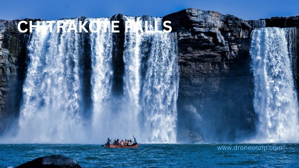
Chitrakote Falls is known for its broad waterfall and surrounding river landscape. Waterfalls can offer powerful wide compositions, but spray, wind and crowds can make close aerial work challenging.
Photography opportunities: Broad landscape views of the falls and surrounding terrain from a permitted location.
What to check before flying: Confirm the current airspace status and any restrictions imposed by the relevant site manager or local authority. Do not assume that a tourist viewpoint allows drone launch or filming.
Practical consideration: Spray and turbulent air near waterfalls can affect equipment and flight stability. Maintain a conservative distance and do not fly if conditions are unsuitable.
How to Check Whether You Can Fly Drone at a Destination
Before travelling with a drone, use the following process to check the intended flight.
Check the official airspace map
Open the DigitalSky platform and examine the exact area where you plan to operate. The map distinguishes Green, Yellow and Red airspace zones.
Green Zone: Operations may be possible without prior airspace permission, subject to applicable rules and other restrictions.
Yellow Zone: The required permission must be obtained from the relevant air traffic control authority before flying.
Red Zone: Operations require the applicable permission from the Central Government and must comply with the relevant restrictions.The zone status can change. Check the current information for the planned flight rather than relying on an old screenshot, a travel blog or a previous visit.
Check local and site-specific restrictions
Airspace status is only one part of the decision. Contact the relevant authority or property manager when a destination involves a protected monument, managed attraction, private land, protected area or sensitive location.
For protected monuments, consult the Archaeological Survey of India and the competent authority responsible for the specific site. Written permission may be required.Confirm that your drone and operation comply
Check the requirements applicable to your drone category, intended use and operation. Review relevant registration, remote-pilot, equipment and operating requirements using current official guidance.
Do not assume that a small or lightweight drone is exempt from every rule.Review weather and the surroundings
Before take-off, assess wind, precipitation, visibility, obstacles, people and emergency landing options. Keep the drone within visual line of sight as required and follow applicable operating limits.
Recheck before take-off
A destination that was suitable during an earlier visit may have different conditions on the day. Recheck current airspace information and any temporary or local restrictions immediately before flying.
For more detail, read DroneUnzip’s guide: How to Check Drone Airspace Zones in India Before Flying.
Important Restrictions Drone Pilots Should Not Overlook
Several common assumptions can lead to poor decisions.
A Green Zone does not mean every activity is permitted
The airspace map helps determine whether prior airspace permission is required. It does not automatically grant access to private property or override separate restrictions that apply at a monument, protected area or managed site.
Protected monuments require special attention
The Archaeological Survey of India’s visitor guidance prohibits drone flying at protected monuments without prior written permission from the competent authority. Do not plan an aerial shot of a heritage site based solely on its appearance in online photographs.
Wildlife and protected areas need careful checks
Before flying near a national park, wildlife sanctuary or other protected area, identify the relevant authority and check the site’s applicable conditions. Avoid disturbing wildlife or habitats, and do not assume that a scenic viewpoint outside a visible boundary is unrestricted.
Crowds and privacy matter
Avoid operating over crowds and respect people’s privacy. A technically possible flight may still be unsafe or inappropriate because of the people and activity below it.
Practical Checklist Before a Drone Photography Trip
Use this checklist when planning your next destination:
- Confirm the exact launch and flight area on DigitalSky.
- Check the current airspace classification and required permissions.
- Confirm local access and site-specific permission.
- Review requirements applicable to your drone and operation.
- Check wind, rain, visibility and temperature.
- Identify obstacles, people, safe landing areas and recovery options.
- Carry suitable batteries and equipment within the manufacturer’s operating limits.
- Respect wildlife, local communities, privacy and protected sites.
- Recheck restrictions immediately before take-off.
Conclusion
India offers a remarkable variety of landscapes for drone photography, from high-altitude valleys and tea plantations to coastlines, salt flats and river islands. The best destination is not simply the one with the most dramatic view; it is one where the planned flight can be carried out safely, responsibly and in compliance with the applicable rules.
Check the exact airspace, confirm local permissions, review weather and surroundings, and be prepared to choose a ground-based shot when flying is not permitted. A little planning can save a trip from becoming an expensive lesson in restricted airspace.
FAQs
Where are the best places to fly drones in India?
Ladakh, Spiti Valley, Munnar, Kerala’s backwaters, Goa’s coastline, the Rann of Kutch, Meghalaya and Majuli offer distinctive landscapes for drone photography. Whether you can fly at a particular spot depends on the current airspace status, site access and applicable restrictions.
How can I find legal places to fly drones in India?
Start with the official DigitalSky platform to check the intended airspace. Then verify local access rules and any separate permissions required by the relevant property owner, site manager or authority.
Can I fly a drone at historical monuments in India?
Do not assume that you can. The Archaeological Survey of India’s visitor guidance states that drone flying at protected monuments requires prior written permission from the competent authority. Check the precise monument and obtain the applicable permission before planning a flight.
Can I fly my drone at a beach in India?
It depends on the exact location, current airspace status, local restrictions and conditions at the site. Check all relevant requirements before flying, and avoid operating over crowds or close to people.
Is a Green Zone always safe for drone flying?
No. A Green Zone does not override other applicable rules, site restrictions, access requirements or safety obligations. Check the current map and the conditions that apply to the particular flight.
