

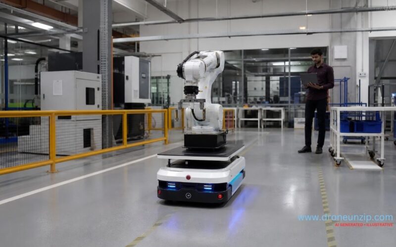
Researchers at IIIT Hyderabad and industrial robotics company Ati Robotics have demonstrated an autonomous mobile robot reaching a designated object on a factory floor without a LiDAR occupancy grid or conventional metric map. The demonstration, described by IIIT Hyderabad on 26 October 2026, relied on camera imagery, visual memory and a foundation model that reconstructs geometry from images.
Key Takeaways
- The demonstration took place on Ati Robotics’ factory floor after a research collaboration lasting approximately three years.
- The robot navigated using a camera, images captured on an earlier traversal and image-derived geometry.
- Researchers say the approach avoids dependence on a LiDAR occupancy grid, scan-matched pose and metric map for the demonstrated task.
- The demonstration does not establish that LiDAR can be eliminated from every industrial robotics deployment.
Who Is Developing the New Robot Navigation Approach?
The work combines the Robotics Research Center at the International Institute of Information Technology Hyderabad with Ati Robotics, an Indian autonomous mobile robot company. The project is part of a wider shift towards more adaptable ground autonomy, also visible in DARPA’s recent demonstration of four coordinated autonomous ground vehicles. IIIT Hyderabad published an account of the research on 26 October, with additional reporting by Indian technology and news outlets. Professor Madhava Krishna described the team’s effort to make robot navigation depend more on visual cues, memory and spatial understanding.
What Did the Autonomous Robot Actually Do?
During the demonstration, an autonomous mobile robot moved across Ati Robotics’ factory floor to a specified object. Instead of localising against a dense laser-derived occupancy map, it used a camera, a sequence of images recorded during an earlier walk through the facility, and a 3D foundation model that infers geometry from pairs of images. The key result was the navigation method, not the difficulty of the destination.
When and Where Was the Demonstration Reported?
IIIT Hyderabad described the work on 26 October 2026, referring to a recent factory-floor demonstration at Ati Robotics. The public account does not establish the exact date of the run or a complete benchmark against LiDAR-based commercial navigation systems.
Why This Matters for Autonomous Ground Vehicles
Traditional autonomous mobile robots often use LiDAR and simultaneous localisation and mapping, or SLAM, to understand where they are. The emphasis on visual understanding also connects with Hesai’s spatial-intelligence work on robotics training data, although the technologies and use cases differ. A visual-memory approach may reduce reliance on dense maps in some environments and allow robots to use higher-level descriptions of objects or destinations. Those are promising applications, but the reporting does not quantify deployment savings or reliability across different factories.
What Must Be Tested Before Wider Adoption?
Industrial sites contain moving people, forklifts, changing inventory, glare and areas with poor lighting. Wider adoption will depend on robust obstacle avoidance, repeatable localisation, safety validation and recovery from unexpected changes. A successful factory-floor demonstration is a meaningful research milestone, not proof of general-purpose autonomy.
Sources
IIIT Hyderabad research feature, Economic Times Electronics,
