

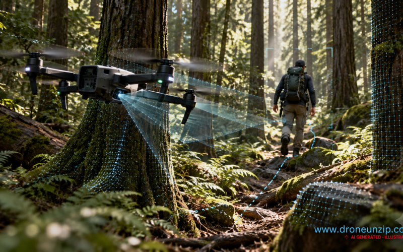
A drone demonstrated by Purdue University researcher Aniket Bera’s IDEAS Lab has been shown following a person through a wooded area while, according to the lab, navigating without GPS, a preloaded map or cloud computing. The short video highlights the promise of onboard autonomy in cluttered environments, but it does not establish performance across repeated field trials.
Key Takeaways
- A 44-second video shows a quadcopter tracking a moving person between trees.
- The research team says navigation and decision-making run onboard without GPS or cloud services.
- Telemetry visible in the footage references SUPER and FAST-LIO, software associated with the University of Hong Kong’s MaRS Lab.
- The demonstration is not proof of a deployment-ready search-and-rescue or military system.
What the Purdue Video Shows
Purdue computer science associate professor Aniket Bera shared footage of a quadcopter following a person through dense woodland. The aircraft appears to maintain a moving target while negotiating tree trunks and changes in the route. Bera described onboard processing and an ability to estimate a person’s trajectory when temporarily obscured by obstacles.
The footage is a demonstration, not a published independent evaluation. The exact airframe configuration, detection accuracy, battery endurance and performance in rain, darkness or varied terrain have not been established in the public material reviewed.
Why Flying Without GPS Is Difficult
Tree cover can degrade satellite reception, while remote environments may lack reliable connectivity. A drone operating without those services needs to estimate its own motion, understand nearby obstacles and continuously plan a safe route using onboard sensors and computation. Following a person adds another challenge: the subject can turn suddenly or disappear behind vegetation.
LiDAR-inertial odometry and local motion planning are among the techniques used in this research field. However, the demonstration video alone is insufficient to independently confirm every sensor or algorithm used on the Purdue aircraft.
The Open-Source Software Question
Independent examination of the video’s telemetry identified the names SUPER and FAST-LIO. These correspond to open-source planning and odometry work from the University of Hong Kong’s Mechatronics and Robotic Systems (MaRS) Lab. Bera’s accompanying description reportedly characterized the system as developed from scratch, but the visible software labels make the extent of original development and reuse an important unanswered question.
These labels suggest a connection to existing open-source components; they do not by themselves establish which versions were used, how they were modified or which parts of the target-tracking system Purdue developed independently. The performance results reported for the Hong Kong team’s separate SUPER platform should not be attributed to Purdue’s forest flight.
Research Context and Potential Applications
Purdue has separately announced a five-year, $1.5 million US Army Research Laboratory agreement concerning GPS-independent aerial and ground robotics. Available reporting does not confirm that the forest-following demonstration was funded by that agreement.
Potential applications for reliable navigation in obstructed areas include locating missing people, inspecting difficult terrain and reconnaissance where satellite signals are unavailable. These are possible future uses, not capabilities validated by this brief public video.
Related DroneUnzip coverage: the Indian Naval Academy’s AI-assisted maritime rescue drone system illustrates another emerging application where autonomous sensing must be paired with dependable real-world operations.
What Remains Unverified
Publicly available footage does not provide a peer-reviewed performance study for this specific demonstration, a reproducible test protocol, quantified obstacle-avoidance reliability or evidence of deployment by emergency responders. It also does not resolve the relationship between the Purdue system and the University of Hong Kong’s published software.
DroneUnzip Analysis: Why This Matters
Analysis: The most significant development is not simply that a drone can follow someone through trees. It is the combination of local sensing, motion planning and target tracking in an environment where navigation aids may fail. If this combination becomes repeatable, affordable and robust, it could make autonomous drones more useful in forests, disaster zones and other complex environments.
Equally important is transparency about software provenance. Reusable open-source robotics tools can accelerate innovation, but accurate attribution helps readers understand what is new and what has already been demonstrated elsewhere.
What to Watch Next
Useful follow-up evidence would include a technical paper, a clear hardware and software inventory, acknowledgment of upstream projects, and longer independently observed tests across varied conditions. Until then, this should be understood as a promising research demonstration rather than a validated operational capability.
Sources
DroneXL technical examination; TechSpot reporting; Purdue UAS Research and Test Facility; University of Hong Kong SUPER project; University of Hong Kong FAST-LIO project.
