

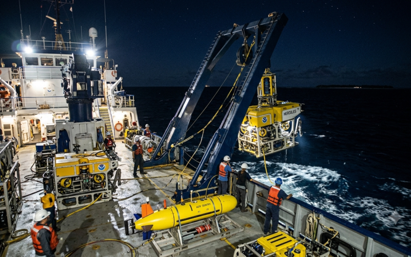
NOAA Ocean Exploration has begun a Pacific expedition designed to test how three autonomous underwater vehicles can operate alongside a research ship, with trials scheduled from October 30 to November 16, 2026, around Hawai‘i and Johnston Atoll.
The mission aboard NOAA Ship Okeanos Explorer brings together a HUGIN 6000 and two smaller Orpheus autonomous underwater vehicles (AUVs). Rather than testing a single robot in isolation, the agency wants to establish procedures for deploying, recovering and integrating several underwater systems into routine exploration work.
Key Takeaways
- NOAA’s EX2701 technology demonstration runs from October 30 to November 16 in the Pacific.
- It involves one HUGIN 6000 and two Orpheus AUVs, all rated for depths of up to 6,000 metres.
- The HUGIN will survey preprogrammed routes up to 150 kilometres long; the Orpheus vehicles will target close-up imagery and sediment samples.
- The expedition is a technology demonstration, not a declaration of completed mission results.
Who Is Running the Underwater Robotics Expedition?
NOAA Ocean Exploration is leading the demonstration aboard Okeanos Explorer, supported by partners associated with the NOAA Ocean Exploration Cooperative Institute. Orpheus Ocean owns and operates the two Orpheus vehicles. The programme will inform how NOAA deploys autonomous systems on its current research ship and its future successor, NOAA Ship Discoverer.
What Will the HUGIN 6000 and Orpheus Robots Do?
The HUGIN 6000 is rated to 6,000 metres and can remain deployed for up to 48 hours, according to NOAA. Its payload includes multibeam and synthetic-aperture sonars, a sub-bottom profiler, magnetometer, camera and conductivity-temperature-depth sensor. It will map poorly surveyed seabed areas using preprogrammed tracks up to 150 kilometres long.
The two compact Orpheus vehicles, also rated to 6,000 metres, carry cameras and pushcore sampling equipment. The team plans to attempt sediment sampling at 5,000 metres, deeper than the vehicles have previously used pushcores. Samples, if recovered, would be analysed by US Geological Survey and NOAA scientists.
When and Where Will the Trials Take Place?
The October 30–November 16 expedition starts with approximately 48 hours of shakedown testing offshore the main Hawaiian Islands. The ship then plans to map during its transit to Johnston Atoll before conducting the main AUV survey programme in remote Pacific waters.
The initial tests are intended to validate launch-and-recovery procedures and calibrate the vehicles after transport. NOAA has not yet reported the final results of the mission.
Why Does Integrating Multiple AUVs Matter?
Ship-based sonar can map broad areas, while remotely operated vehicles provide detailed views of relatively small locations. Autonomous underwater vehicles could help bridge that gap by collecting higher-resolution information over substantial distances without requiring continuous shipboard control.
NOAA says the operating area also includes locations of interest for marine critical minerals, although the expedition is framed as exploration and technology evaluation, not a mining operation.
DroneUnzip has previously covered modular underwater vehicle payloads in Australia’s Ghost Shark programme, a different application that similarly highlights the importance of adaptable unmanned-system architectures.
What Happens Next?
The immediate measure of success will be whether NOAA can repeatably launch, recover and manage both AUV types while gathering useful survey and sampling data. Post-expedition analysis will determine what can be incorporated into future shipboard operations. Planned dives, route lengths and sample depths should not be mistaken for confirmed completed achievements.
